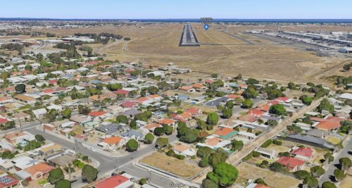
Located smack bang in the middle of South Australia’s capital city, Adelaide Airport has an interesting runway approach lighting system – located in suburban streets and residential backyards!
Some background
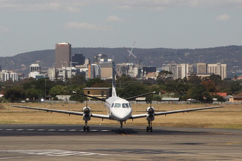
Adelaide Airport is located approximately 6 kilometres from the Adelaide CBD.
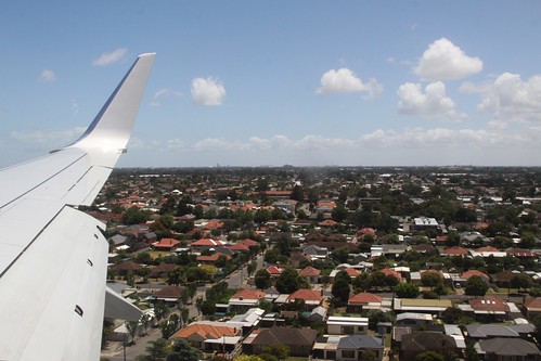
With the suburbs of Brooklyn Park and West Richmond under the approach path to the main runway.
Approach lighting directs aircraft towards runway 23.
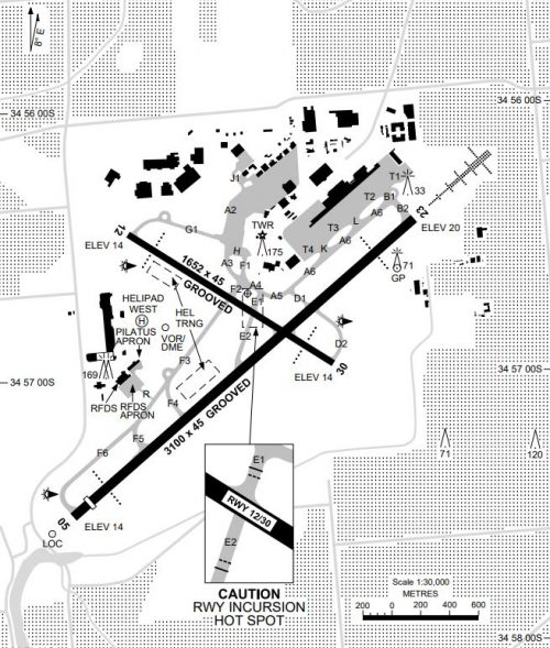
Airservices Australia – YPAD Aerodrome Chart
But the airport land ends just a short distance away from the runway threshold.
So the approaching lighting continues beyond the airport fence.
On the hunt for approaching lighting
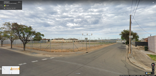
The first set of approach lights are found at the corner of Morley and Trennery Street, on a piece of land fenced off from the public but outside the airport perimeter fence.
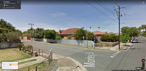
Turn 180 degrees, and you’ll find a another gantry holding approach lights, this time just sitting beside the nature strip.
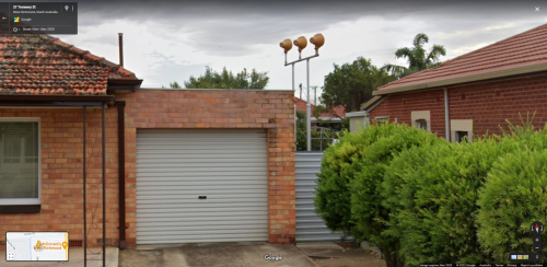
Heading along Trennery Street, you’ll find a set of lights wedged between two houses.
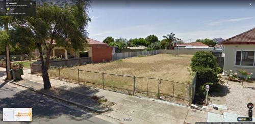
A few doors down is an short fence on an empty block of land, and a set of runway lights at the rear.
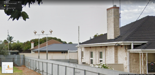
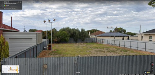
Around the block on Ralph Street, there is a set of lights in a backyard.
And another on the block next door, which no longer has a house on it.
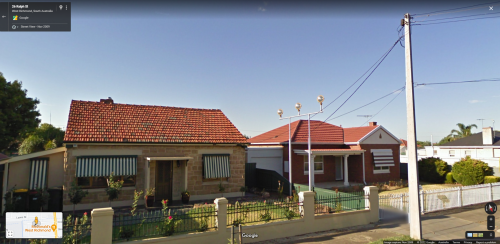
Next door the runway light is in the front yard.
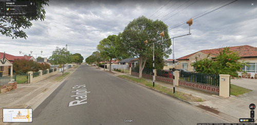
Down the street is another gantry just chilling on the nature strip.
And few houses along I found the last set of runway lights – on a double block of land with a short fence preventing public access.
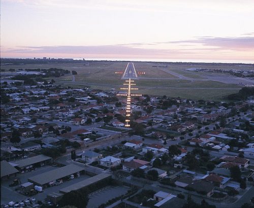
All lit up at night, they look like this.
So who owns the land?
The Adelaide Airport master plan details current and future aircraft approach lighting situation.
Aircraft approach lighting is operated and maintained by Adelaide Airport Limited (AAL). The approach lighting is located at the ends of the Adelaide Airport runways, extending into residential areas at West Richmond for Runway 23 where such lighting is generally held under easement or by ownership of specific allotments.
The long-term continuity of this lighting in the vicinity of the current sites is aligned with aviation services at Adelaide Airport. It is possible that such lighting will be replaced with more efficient systems within the next 20 years.
AAL has purchased freehold land outside of the airport site to ensure the long-term protection of the runway approach lighting corridor. Additional land will be secured as it becomes available. The freehold land is not subject to the airport lease arrangements or Airports Act regulatory framework.
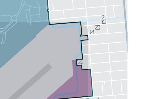
The parcels of freehold land are indicated on the master plan map.
And include:
- the three parcels I’ve already identified on Trennery Street and Ralph Street,
- one parcel on Lyons Street which is empty,
- and a parcel on Britton Street which adjoins the airport.
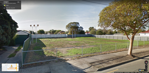
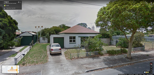
The most recent acquisition appears to be 17 Ralph Street – older Google Street View imagery shows the runway lights in a backyard, not an empty block. The property was sold in June 2017 for $325,000.
Another hut
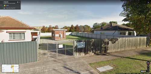
In between houses on Press Road in Brooklyn Park I found another aviation related building – an Airservices Australia equipment hut.
Located around 1000 metres from the end of Adelaide Airport runway 23, I suspect it houses the instrument landing system (ILS) ‘Middle Marker’ beacon transmitter.
More lights on Marion Road
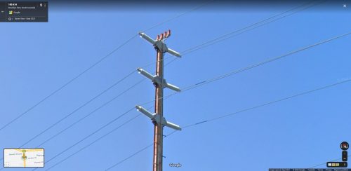
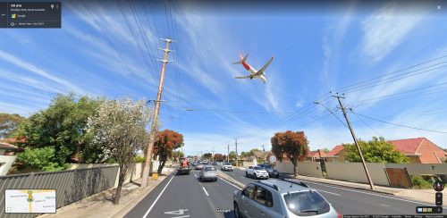
Over on Reddit someone mentioned that the high voltage power lines along Marion Road also have aircraft warning lights atop them.
A total of 10 power poles have them – stretching from Brooklyn Avenue in the north to Knight Street in the south – seen here with a Qantas 737 flying overhead.
And another lucky Google Street View catch
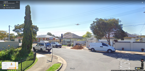
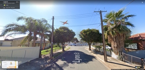
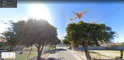
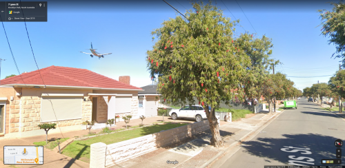
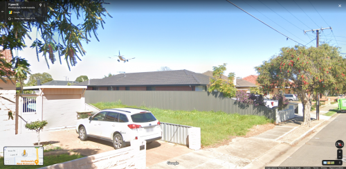
Back in September 2019 the Google Street View car was driving down Lyons Street in Brooklyn park where it captured something interesting in the sky.
A Jetstar A320 to be precise.
Coming in over the the houses.
And in to Adelaide Airport.
A technical footnote
The Airservices Australia Aerodrome Chart lists the following approach lighting at Adelaide Airport.
Runway 05: HIRL MIRL
Runway 23: HIRL MIRL HIAL – CAT 1 HSL
Runway 12: MIRL
Runway 30: MIRLNotes:
– HIAL non-standard 4 bar system
– HIAL CAT 1 aligned with ILS GP
Translated into something resembling English.
HIRL: High Intensity Runway Lights
MIRL: Medium Intensity Runway Lights
HIAL: High Intensity Approach Lighting System
HSL: Hold Short Lights
And ILS GP:
Instrument Landing System Glide Path
Sources
- Adelaide Airport charts, Airservices Australia
- Adelaide Airport master plan
Further reading
- Adelaide Airport: a brief overview of its history by the West Torrens Historical Society
- Planespotting in Adelaide at Weekend Notes
- Adelaide Airport at spottersguide.net

Vividly remember as a kid in the early-mid 80’s being shown these by my parents when we lived there, went for a drive thru there soon after installation, amazed that these could be put in front and back yards. I seem to remember they were installed to allow international flights to go into Adelaide. Moved to Launceston in late 90’s, Launceston airport approach from the south has similar, 2 lights in the back yard of a property at 437 Evandale Rd and thru the paddocks
Nice find – there is also a set of Airservices Australia radio towers a little down the road.
https://www.google.com/maps/@-41.5608128,147.2258463,3a,75y,280.98h,94.25t/data=!3m6!1e1!3m4!1soFB47jP3J2FD7qj9OwSJhA!2e0!7i13312!8i6656
The master plan map you’ve included seems to indicate the airport also owns the three properties on Trennery and Ralph with lights on the land in addition to the four empty properties pointed out. If that’s the case, it’s interesting those houses have not also been razed.
I’m guessing Adelaide Airport has bought houses along the runway corridor whenever they come up for sale, ready for any future upgrade to the runway approach lights.
Interesting.
Btw, Düsseldorf Airport in Germany also has runway lights in residential areas.
Thanks!
I found some lights between houses for Düsseldorf runway 05R here:
https://www.google.com/maps/@51.2761656,6.7451646,3a,75y,345.41h,101.56t/data=!3m6!1e1!3m4!1scqZYIDdBzSqqrfvhjk3iig!2e0!7i13312!8i6656
And in a paddock for 05L:
https://www.google.com/maps/@51.2799696,6.7405931,3a,37.6y,59.39h,92.23t/data=!3m6!1e1!3m4!1shvgMUwAYNZrHLNerGAEcXQ!2e0!7i13312!8i6656
[…] story starts when I published a piece on the backyard approaching lighting at Adelaide Airport to my […]
I’ve also driven around those sites at West Richmond where the approach lights are multiple times over the decades, and always been fascinated by them – especially how they’re in such bizarre places, like footpaths, between properties and in back yards.
As an aside, runway 23 used to have an outer marker (2 radio beacons) at a fenced- off field in Modbury (Smart Road). These towers were removed in either late 2018 or early 2019. They can still be viewed in google street view if you change the date to pre-July 2019: https://www.google.com.au/maps/@-34.8327716,138.6988205,3a,75y,27.7h,91.7t/data=!3m7!1e1!3m5!1sAc0dgvVtSlArYgOMLdvhVQ!2e0!5s20180501T000000!7i13312!8i6656
A nearby sidestreet was appropriately named “Radar St”.
According to Wikimapia the installation at Modbury was a NDB (Non-directional beacon), callsign MBY.
http://wikimapia.org/9738066/Modbury-NDB-ID-MBY
It was removed from operational use in 26 May 2016 as part of Airservices Australia’s ‘Navigation Rationalisation Project’:
https://docplayer.net/44935638-Navigation-rationalisation-project.html
The project saw a swathe of ground-based navigation aids (NDBs, VORs and DMEs) switched off, with pilots switching to GNSS (Global Navigation Satellite System) for navigation.
https://australianaviation.com.au/2016/05/airservices-to-begin-turning-off-ground-based-navaids-from-may-26/