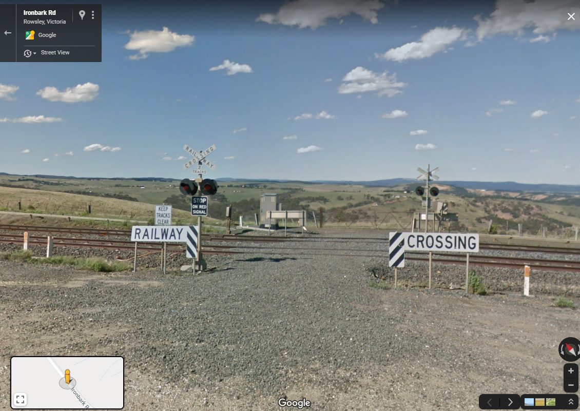
Across Melbourne the Level Crossing Removal Program is removing conflict points between road and rail vehicles, but elsewhere in Victoria there is something a little stranger -level crossings that lead nowhere. Google Street View In the paddocks of Bacchus Marsh Back in 2006 a level crossing on the recently upgraded Ballarat line outside Bacchus Marsh […]
Archive for July, 2020
Photos from ten years ago: July 2010
Another instalment in my photos from ten years ago series – this time it is July 2010. Down on Spencer Street For Melbourne Open House 2010 CitiPower opened ‘JA’ zone substation – a key part of the power supply to the Melbourne CBD. For historical reasons the substation was divided into two – the State […]
On the road to nowhere in Rockbank
Years ago I was wandering through paddocks of Rockbank photographing trains, when I came across an odd sight – a ‘Road Closed’ sign hidden in the grass near the intersection of Hopkins Road and Greigs Road. So how did the road come to be? Going back to the gold rush A check of land titles […]
Cowies Hill and a deviation on Tarneit Road
The western suburbs of Melbourne lie on flat and otherwise featureless volcanic plains, covered by a grid of main roads. But out at Tarneit there is something to break the monotony – Cowies Hill, and a curious road deviation. Cowies Hill is located between Sayers Road and Leakes Road, with Tarneit Road skirting the edge […]