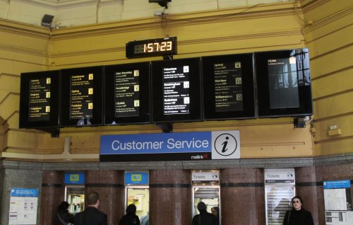
You have arrived at Flinders Street Station and you’re trying to find where your trains leaves – so where do you look? You’re probably going to look at one of these screens – but what order are the trains being displayed in? It isn’t alphabetical – South Morang occupies the first two slots. Is it […]
Posts Tagged ‘network maps’
Gone but not forgotten – the route 24 tram
May 8th, 2015
4 Comments
As part of the July 2014 tram timetable change, the peak-only route 24 service from North Balwyn to La Trobe Street via Kew was discontinued. So what is it still visible on Google Maps?
Confusing network maps from V/line
January 30th, 2015
8 Comments
Back in April 2014 Public Transport Victoria released a draft of an >easier to read train map for Melbourne, and not a minute too soon – the current version implies non-existent options routes such as a Sunbury to Upfield line. So what about the V/Line network map?
Brisbane’s multi-coloured rail network map
September 30th, 2014
1 Comment
A few weeks ago I made my way north to Brisbane, where I caught plenty of trains. However it was the next train display boards at the main entrance to Roma Street Station that caught my eye – they were colour coded.