Removing level crossings is the current flavour of the month in Melbourne, as the continuation of a long and close process to separate road and rail traffic, but it raises a question – how long since the last brand new level crossing was built on a greenfields site?
Some background
For almost 15 years the creation of new level crossings in Victoria has been blocked by government, thanks to the passing of amendment VC016 to the Victoria planning scheme in September 2002:
Amend the clause 18.01-2 of SPPF to require transport routes to be designated to provide for grade separation at railways.
Public Transport Safety Victoria expand further in their Road/Rail Safety Interface Agreements guidelines:
Planning scheme amendment 18.01-2 of the State Planning Framework states that “design of transport routes must provide for grade separation at railway crossings except with the approval of the Minister for Transport”. This policy is primarily intended to prevent the construction of new roadway level crossings.
A notable level crossing rejected by this policy change is Aylmer Road on the Cranbourne line.
City of Casey councillor Damien Rosario explains further:
In the early 1990s the State Government approved development plans for the Lynbrook/Lyndhurst area with a level crossing at Aylmer Road, with developers required to make contributions for the level crossing.
However a few years ago, when Council was planning to construct the level crossing, the State Government changed the rules to prevent any further level crossings throughout Victoria. This meant that connectivity between Lynbrook and Lyndhurst could only be achieved via an overpass or an underpass.
The current version of the Lynbrook and Lyndhurst Development Plan still makes reference to an “at-grade” crossing at Aylmer Road reflecting the original planning for the area. Council will be updating this document to recognise the change in circumstance brought about by the State Government’s changes to railway crossing planning.
So when did the last new level crossing get built?
Finding the candidates
Melbourne was a early builder of railways, with the majority of today’s network in place by 1890 – a time long before mixing road and rail traffic was a concern!
In the decades that followed a few short rail extensions were opened in suburban Melbourne – the Princess Bridge-Victoria Park direct route in 1901, the Albion-Jacana freight line in 1929, and the the eastward extension of the Glen Waverley line in 1930.
With motor cars beginning to fill the roads, the railways mentioned above were all grade separated from the start – no level crossings at all!
You might think that would throw a spanner in my search, but if we move forward to the 1980s we find the trail again – on the Altona line.
Originally opened as a short single track branch line to Williamstown Racecourse in 1885, the line was extended to the beachside town of Altona in 1888. There it remained until 1985 when the line was extended west to Laverton, via the new station of Westona, to form a through route to Werribee.
Thanks to the narrow rail corridor, the cheapest way to extend the line was a single track at ground level, resulting in two new road/rail level crossings: Grieve Parade, and Maidstone Street.
We then have an explosion of new level crossings created in 1986, with the opening of the Webb Dock railway line.
Built to link to Port of Melbourne with the wider rail network, the line ran at grade from the rail yards next to Southern Cross Station, crossing the Yarra River, and then running parallel to Lorimer Street, Todd Road and Wharf Road, before passing under the West Gate Bridge and arriving at the port. Along the way almost a dozen roads were crossed, the majority of them being access roads to neighbouring wharf sheds.
The Webb Dock railway closed in 1996, sparing motorists the level crossings, but the trucks that took their place cause so much traffic congestion reopening the railway is a recurring idea.
We now skip forward a few years, over to Dock Link Road in West Melbourne.
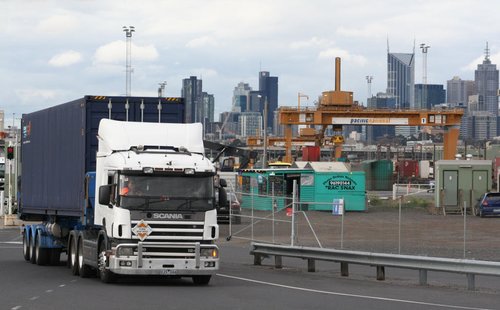
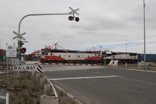
Opened in the early 1990s so that trucks from the Port of Melbourne could access the South Dynon rail freight terminal, this level crossing was quite a beast – originally seven (!) tracks crossed the road, but was reduced to five in 2009 as part of the ARTC ‘Missing Link’ project.
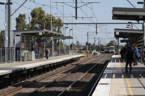
Then end at the spartan facilities that pass for the railway station at Keilor Plains.
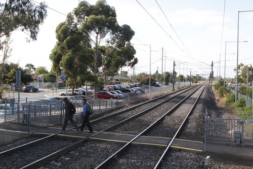
Keilor Plains station opened in 2002, as part of the extension of the electrified network from St Albans to Sydenham. Located a short distance south of Taylors Road, there was no easy way for passengers to access the new station, so a ground level pedestrian crossing was provided at the city end of the platform.
So there we have it!
- 1986: last new road/rail level crossing on a Melbourne suburban line (Maidstone Street, Altona on Werribee line)
- 1993: last new road/rail level crossing in Melbourne (Dock Link Road, West Melbourne)
- 2002: last new level crossing in Melbourne (Keilor Plains station, Sunbury line)
Footnote
By expanding the criteria to include expanded level crossings, the list grows longer: in 2007 Craigieburn station received a pedestrian crossing instead of an underpass, and in 2016 the crossing at Cardinia Road on the Pakenham line was duplicated.
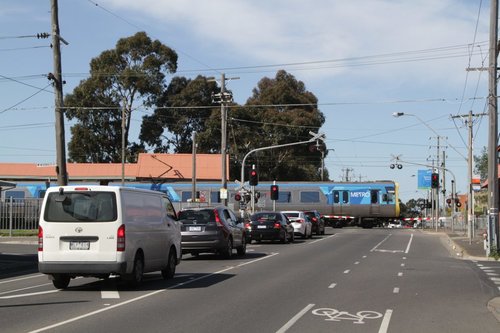
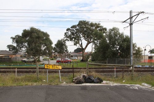
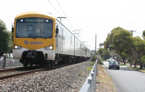
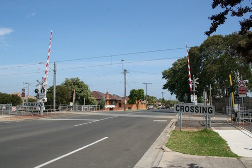
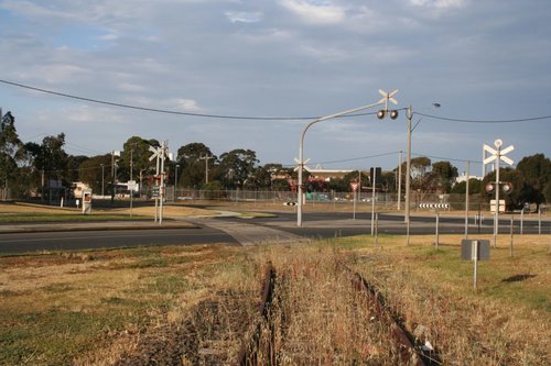

While not a new crossing as per say but definitely an oversight at the time would be not taking the opportunity to remove any crossings when they electrified the line to Sunbury.
Neither Werribee electrification of the 1980s, Cranbourne electrification of the 1990s, or the Sydenham electrification of the 2000s included any level crossing removal work.
The exception only was the extension to Craigieburn which removed the level crossing at Somerton Road – note freight trains on the Melbourne-Sydney line also passed through there, and the work also included duplication of the road.
Again not a new crossing, but the New St Brighton hand gates were closed in 2007, then ‘shut permanently’ in 2010, then subsequently replaced with electric boom gates, to essentially provide a new level crossing.
Don’t forget that in 2011 the Baillieu government proposed grade separating the crossing!
http://www.theage.com.au/victoria/brighton-crossing-upgrade-turns-into-express-priority-20111005-1l9q4.html
It took them a year to realise it was a stupid move:
http://www.theage.com.au/victoria/brighton-boom-gates-jump-queue-20120722-22i6p.html
I had no idea that the Webb Dock line is that new. Same with that level crossing in an industrial area.
But even before the motor car, there was still road traffic, in the form of animal drawn wagons, pedestrians and trams. Actually even then, mixing road and rail traffic was still sometimes a concern:
*Victoria Railways (V.R) who ran our railways at the time, was opposed to level crossings with cable trams.
*There were some grade separations, not all along tram routes, even back then, for example South Yarra to Caulfield.
Grade separations benefit all road users, including pedestrians. If you look at the current level crossing removal programme, you’ll see that most of the level crossings listed are next to stations. So stations can be rebuilt at the same time as the crossing is grade separated, and there is a benefit for people walking to and from the station.
Many of the grade separation projects of the 1920s were to separate trams and trains – a listing can be found here:
http://www.hawthorntramdepot.org.au/papers/lvlcross.htm
I’ve seen that list and it only includes grade separations along electric, not cable trams routes. In this case, only ones grade separated after that tramway was opened.
It does not include cases where the level crossing was grade separated at the same time as the tramway was built or before then.
Be interested to know more of level / grade separation policies, going way back – for instance there was a great rebuilding program in 1910-1920 with electrification, elevating or sinking Belgrave Lilydale from Hawthorn Station to east Camberwell (a few hills at the Camberwell end helped), and South Yarra to Caulfield – perhaps this was as much about avoiding tram crossings as safer train lines ? Plus motor traffic in those area would have been increasing.
Apart from that, the only other grade separation project before the modern era I know of was Canterbury Station, elevated in the 1960s.
From the data I’ve collated there was a handful of grade separations completed pre-electrification, the two large regrading programs you mentioned, a handful more removals in the 1920s, then a massive gap until the passing of the ‘Country Roads and Level Crossings Funds Act’ in 1954.
Marcus,
I believe that there was another new level crossing that was constructed in the Port area back in 2003 that you have not mentioned in your article.
It is the one at the southern section of Dock Link Road to the south of Footscray Road and was part of the new rail siding built to West Swanston Dock.
Here is a link to a Railpage thread you contributed to at the time.
https://www.railpage.com.au/f-t553.htm
Ross
I totally missed the various sidings that cover that side of the Port of Melbourne.
The sidings at Appleton Dock existed as early as the 1960s:
http://www.signaldiagramsandphotos.com/mywebpages/vr/Metropolitan/1'66.htm
But the 1970s the sidings to Swanston Dock had been opened:
http://www.signaldiagramsandphotos.com/mywebpages/vr/Metropolitan/4'77.htm
With little change by 1993:
http://www.signaldiagramsandphotos.com/mywebpages/vr/Metropolitan/14'93.htm
After this point many sidings did get removed from the area, only to be relaid in the early 2000s. The question is whether to count these crossings as new or reopened.
I wonder what effect the level crossing policy has on extending electrification of existing lines over country routes in the outer metropolitan area. As it was they were able to electrify the existing line for Cranbourne in the 1990’s and more recently Sydenham and Sunbury leaving the existing level crossings intact and grade separating ones where the traffic warranted like Taylors Road in Keilor and soon to be Melton Highway in Sydenham.
Will a Melton electrification require a full or part grade separation soon after they do work to duplicate the line past Caroline Springs. Specifically the messy arrangement of the Fitzgerald Road crossing located under the M80 Ring Road overpass will prove a headache given they will need to keep the line open without messy land acquisition next door.
Another way to look at these projects is that the only physical change is stringing overhead wires above the tracks – in the case of electrification to Sunbury, the frequency of train services hardly changed.
Compare this to the Geelong line: train services increased from hour to every 20 minutes, tripling the number of trains through level crossings in Geelong, with no infrastructure changes.
Meanwhile the Ballarat line west to Melton is being duplicated through the numerous existing level crossings between Caroline Springs and Melton – many of them are just minor roads, but with the new housing development currently underway, they’ll be dual carriageways with a 80 km/h speed limit within a decade.
For Fitzgerald Road the level crossing at Ardeer, I’d send the road over both the railway and parallel road at the same level as the Western Ring Road, then loop around back to round level via acquired land, with a north facing ‘T’ intersection with Forrest Street / Tilburn Road.
How does the the M80 Trail fit into your plan? Would it be up on the bridge between the Ring Road and Fitzgerald Rd extension?
In the leadup to the 2006 State Government election, then opposition leader Ted Baillieu made a commitment to build the South Morang rail extension for a cost that was significantly less than Labor and would have included I believe 2 level crossings.
Similarly he committed to extending the Cranbourne line to Cranbourne East for a very small amount of money which would have involved reactivating level crossings.
As it turned out Baillieu was unsuccessful at that election, so the potential new or reactivated level crossings never eventuated. When Baillieu eventually was successful in 2010 the South Morang project had been completed and his party made a different set of promises and neglected Cranbourne East.
$12 million to extend the Epping line to South Morang!
http://www.abc.net.au/news/2006-11-01/opposition-pledges-to-extend-epping-rail-line/1299476
And less than $10 million for a 1.5-kilometre extension of the Cranbourne line and new station at Cranbourne East?
http://www.theage.com.au/news/vicelectionpolicy/baillieu-to-extend-cranbourne-line/2006/11/02/1162339984933.html
Speaking of South Morang, that project included duplication from Keon Park to Epping (circa 2011), which presumably means the crossings in that section were expanded at that time.
Looking at this 2010 diagram, the following level crossings were expanded:
http://www.signaldiagramsandphotos.com/mywebpages/vr/Metropolitan/65'2010.pdf
– Keon Park to Thomastown: Settlement Road and Heyington Avenue
– Thomastown to Lalor: Thomastown station (pedestrian), ‘Mann’s Crossing’, Darrick Street (pedestrian)
– Lalor to Epping: Partridge Street (pedestrian), Childes Road
I’m looking forward to level crossings along there being removed. Specifically:
1. Station St, with the addition of a bike path across the tracks connecting Main St to The Blvd (wasn’t done as part of the new Thomastown Station, and Station St crossing is far from ideal location for that route); and
2. The junction design for a Wollert extension near Lalor Station.
[…] in 2017 I looked at when did Melbourne stop building new level crossings – and the previous newest crossing was around the corner at Dock Link Road, opened in the […]
Some more level crossings that were reopened were on the Lakeside – Gembrook section of the Puffing Billy Railway when it was reopened in 1998, namely Wright Road, Healesville – Koo Wee Rup Road (McBride St), Doonaha Road, Orchard Rd and Belgrave-Gembrook Rd, plus three Occupation crossings.
On the subject of early level crossing removals, Inkerman Street on the Sandringham line was grade separated in 1893. Earlier LXRs were Jolimont Rd, Punt Road, Swan Street and Mount Alexander Road (Essendon).
Thanks for that – hadn’t considered the Puffing Billy line!
A longer list of early level crossings removals can be found over at Vicsig.
https://vicsig.net/infrastructure/crossings/gradesep