Today we’re taking a ‘then and now’ tour over the West Gate Bridge.
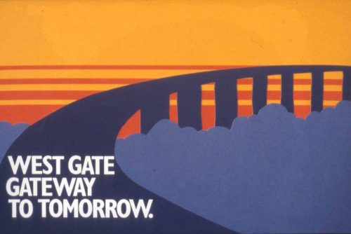
PROV image via West Gate Tunnel Project
Approaching the Lower Yarra Freeway
We start on the Prices Highway way back in 1969, one mile away from the junction with what was then called the ‘Lower Yarra Freeway’.
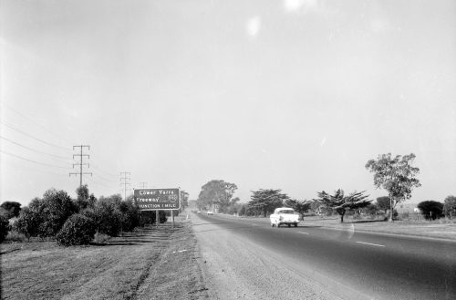
VicRoads photo, via West Gate Tunnel Project
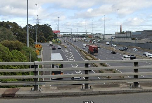
And the view today – the ‘Lower Yarra Freeway’ is now called the West Gate Freeway, the Princes Highway via Footscray is now the secondary route, the two lanes have doubled to four, and the Western Ring Road has been added to the junction.
And the changes can also be seen at the freeway junction itself.
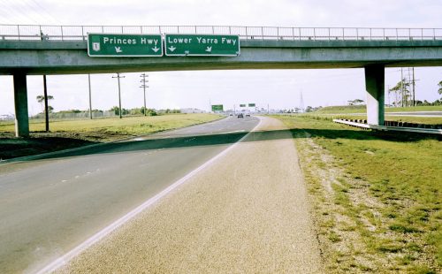
VicRoads photo, via West Gate Tunnel Project
Dohertys Road over the freeway having been duplicated in 2021, with more lanes underneath to come as part of the West Gate Tunnel Project.
On to Williamstown Road
We now move onto this 1970 view from the West Gate Freeway at Williamstown Road – an ‘End Freeway’ sign attached to the footbridge – the West Gate Bridge having collapsed during construction on 15 October 1970, with the death of 35 workers.
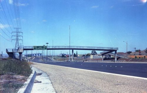
VicRoads photo, via West Gate Tunnel Project
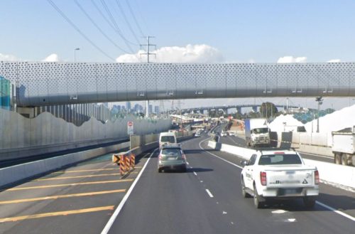
And the view today with a completed bridge, and changes thanks to the West Gate Tunnel Project – tall concrete noise walls, the Woduyullul Parring footbridge completed in 2020 to replace the previous open air footbridge; and small footprint steel monopole towers that replaced the traditional lattice towers supporting the 220 kV transmission lines.
Onto the bridge
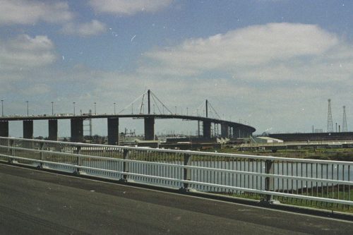
No traffic in this view of the West Gate Bridge before it was officially opened.
VicRoads photo, via West Gate Tunnel Project
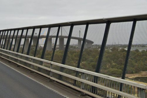
But the main difference today – the suicide barriers hurried erected in 2010 after years of the government refusing to do so.
Check out the view!
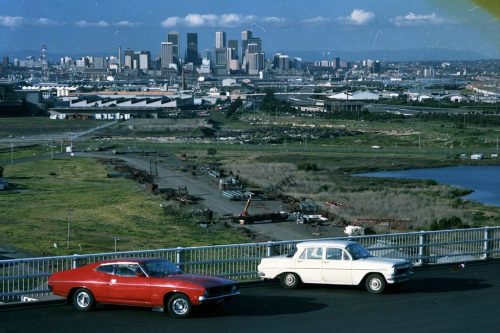
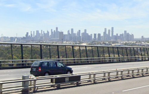
And here is the view from the top, looking over to the Melbourne CBD.
VicRoads photo, via West Gate Tunnel Project
With 40 years of development filling out the skyline.
And down below
Headed through Port Melbourne
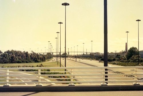
We start off at Graham Street interchange in Port Melbourne, with this 1983 view looking west towards the West Gate Bridge.
VicRoads photo, via West Gate Tunnel Project
And the view today – the trees are taller and the ‘UFO’ lights are gone, and more importantly, Graham Street doesn’t traverse the bridge anymore. Instead the bridge forms the connection between the Bolte Bridge and the West Gate Freeway, with the Graham Street severed in 1997 so that construction of the CityLink project could proceed.
And over South Melbourne
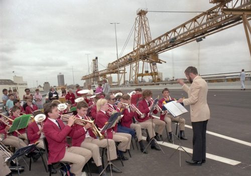
Now we are in 1987, and it is opening day of the first stage of the elevated West Gate Freeway extension through South Melbourne to St Kilda Road.
VicRoads photo, via West Gate Tunnel Project
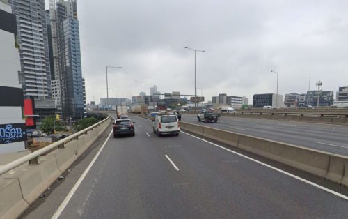
While the view today shows the connection through to CityLink completed in 2000, and additional lanes added in 2011 as part of the Monash–CityLink–West Gate Upgrade project.
Footnote: a bonus bridge
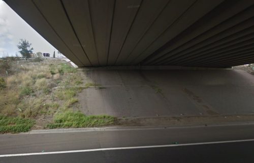
And here’s a 1971 photo of workers having a smoko beneath the Grieve Parade overpass.
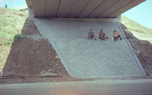
VicRoads photo, via West Gate Tunnel Project
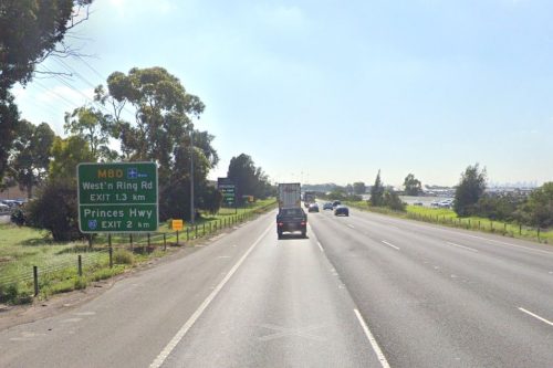
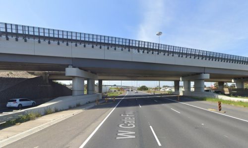
In 1991 the original bridge was widened as part of the duplication of Grieve Parade – the original two lane span being joined by another four lane bridge to the west side.
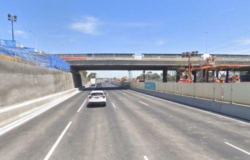
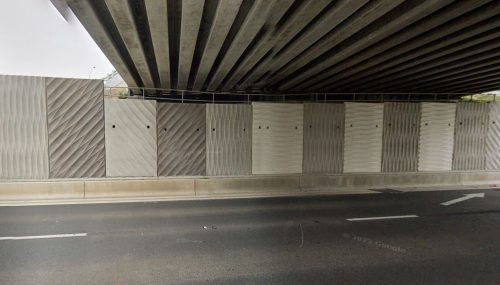
But the heavier trucks of today were too much for the original bridge to handle, and so in January 2021 the spans were demolished as part of the West Gate Tunnel project.
The eastern half rebuilt with stronger concrete super-T beams, and the earthen embankments cut back to fit more traffic lanes beneath.

Fascinating about Grieve Parade bridge.
Crossing the bridge regularly now and being involved on the periphery with the upgrade, I had always wondered how the road network worked before the upgrade. I had assumed it was an addition of new bridge section rather than replacement. Replacement makes much more sense.
The replacement beams are not actually super Ts. Rather than a hollow box section, they are much closer to an I cross section through the middle portion of the beam.
I presume this is to match the older beams. Probably useful from both an aesthetic perspective, but also functionally – matching deflections and behaviour etc.
Similar to how the new infill above Forster Rd matched the old very complex beam profile. Would have been much simpler to use Super Ts, but the old profile was matched.
Thanks for the extra into about the beams used.
As for Forster Road, I’d never noticed the infill there.
https://www.google.com/maps/@-37.892812,145.130371,3a,75y,88.91h,91.48t/data=!3m7!1e1!3m5!1sZfaonWuOkD2Ipq7LvUFXqA!2e0!6shttps:%2F%2Fstreetviewpixels-pa.googleapis.com%2Fv1%2Fthumbnail%3Fcb_client%3Dmaps_sv.tactile%26w%3D900%26h%3D600%26pitch%3D-1.47911622563457%26panoid%3DZfaonWuOkD2Ipq7LvUFXqA%26yaw%3D88.91005793600294!7i16384!8i8192?entry=ttu&g_ep=EgoyMDI0MTIwOC4wIKXMDSoASAFQAw%3D%3D
Furlong Road on the Western Ring Road was a bit similar, but it was extended both in the middle and to one side.
https://www.google.com/maps/@-37.7614326,144.82082,3a,75y,9.48h,92.96t/data=!3m7!1e1!3m5!1syXtg4EfZi2nN_oBxnsPZ3Q!2e0!6shttps:%2F%2Fstreetviewpixels-pa.googleapis.com%2Fv1%2Fthumbnail%3Fcb_client%3Dmaps_sv.tactile%26w%3D900%26h%3D600%26pitch%3D-2.9584581703192896%26panoid%3DyXtg4EfZi2nN_oBxnsPZ3Q%26yaw%3D9.476590532302964!7i16384!8i8192?entry=ttu&g_ep=EgoyMDI0MTIwOC4wIKXMDSoASAFQAw%3D%3D
great photos
And thanks to VicRoads’ predecessors documenting their work. 😀
For quite a few years Bicycle Victoria ran the very popular Great Melbourne Bike Ride across the Westgate Bridge, the views were great.
I did it years ago as a teenager, on the shorter course from Albert Park to Williamstown, and the long climb up the West Gate Bridge almost killed me!
As part of the WestGate Tunnel project the freeway was also lowered under Grieve Parade, when the West Gate was first constructed the current freeway clearance standards had yet to be developed.
Interesting – I hadn’t noticed that.
Hey Charger!
The way the nice looking cars were all lined up makes me think that it was a public open day on the yet to open bridge.