Many roads across Melbourne are subject to load limits, to prevent heavy trucks from passing through residential areas. But when I went for a wander around the streets of Sunshine I found a curious sign, referencing a street that doesn’t exist So what’s the story behind ‘Graham Street South’?

Hot on the trail
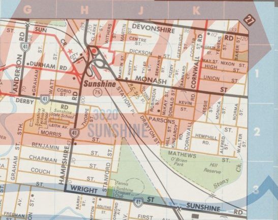
A check of the current Melway edition shows a ‘Graham Street’ in Sunshine, parallel to Anderson Road between Sun Crescent and Derby Road.

Melway map 40, 2020
But checking the Land Victoria database wasn’t much help – no ‘Graham Street South’.
Land Victoria 2018
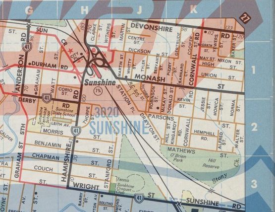
But it was Melway Edition 1 that gave me the answer – Graham Street once continued south past Sunshine High School all the way to Wright Street, on what is now called Anderson Road.

Melway Edition 1, 1966
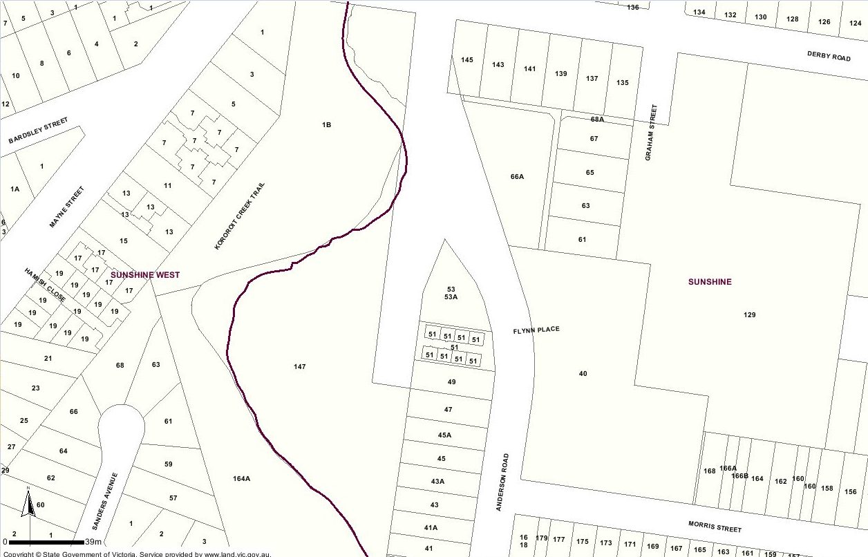
On the ground, the connection no longer exists.
Hitting a dead end.
A nursing home built on the site.
But a nearby street sign on Anderson Road proclaims ‘Formerly Graham Street South’.

Bingo.
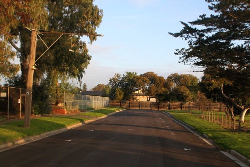
So why a kink in the road?
Kororoit Creek runs parallel to today’s Anderson Road.

An advertisement for the 1890s ‘Post Office Estate’ land subdivision shows the planned road network in the area – Anderson Road running parallel to ‘Anderson Street’ south of Derby Road.
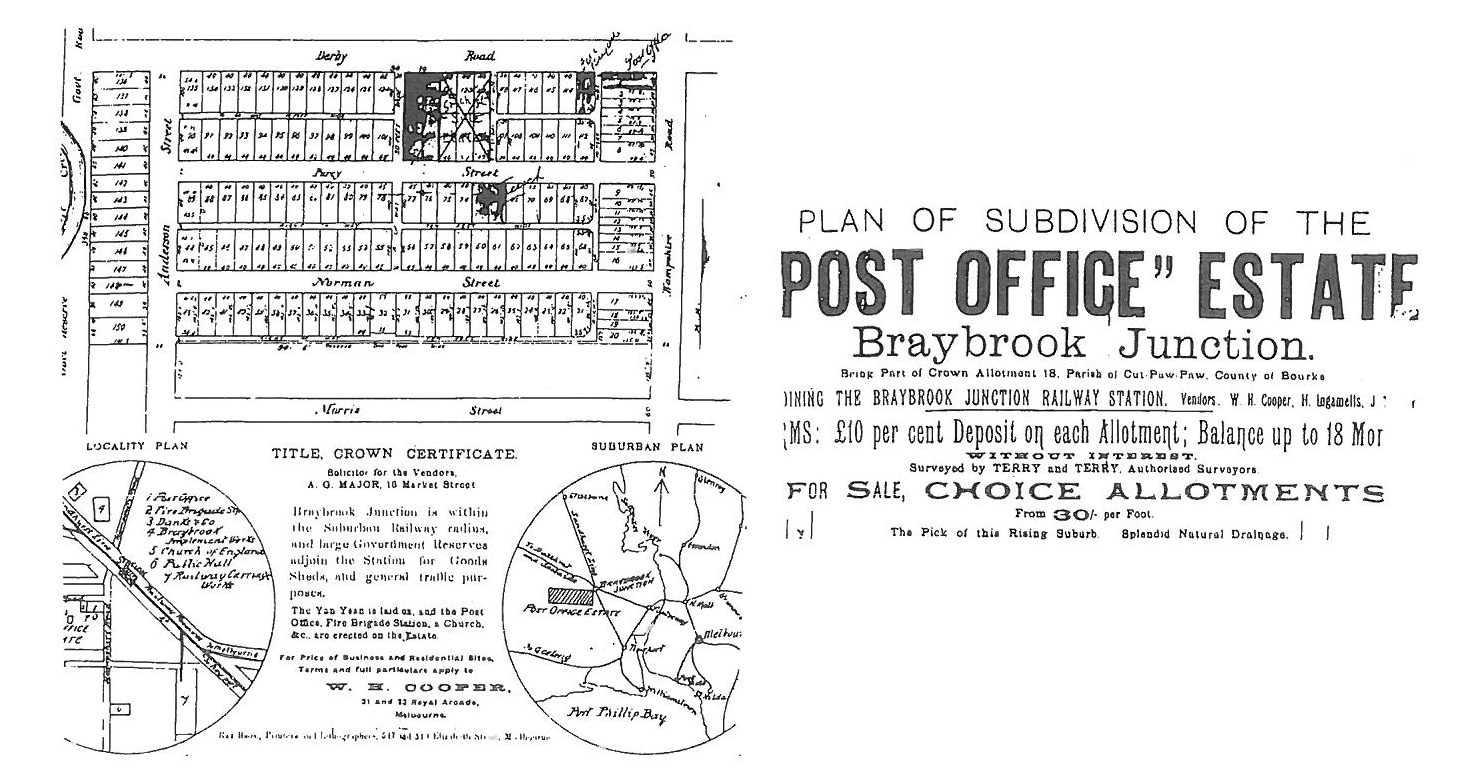
From History of School 3113 Sunshine
And this 1939 Melbourne and Metropolitan Board of Works plan showing what was actually built – ‘Anderson Street’ connecting to Wright Street at the southern end.
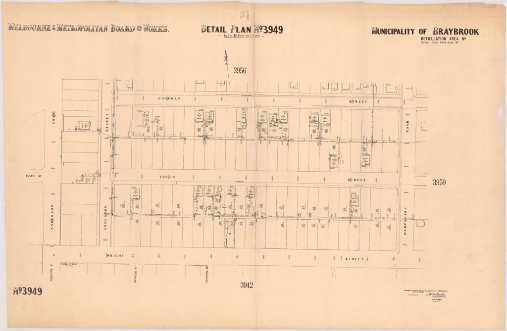
1937 MMBW plan
With the south end of Anderson Road being today’s Ardoyne Street, disconnected from the northern half thanks to Kororoit Creek.

1937 MMBW plan
But the northern end of Anderson Street was never built – this 1945 aerial photo shows a kink in the road connecting it to Graham Street.

Victorian Department of Lands and Survey imagery
As does this undated plan.

Undated MMBW plan
What happened to the connection
My starting point was The University of Melbourne, who have digitised every Melway edition from 1966 to 1999. Edition 5, 1971 features the original kinked road connecting to Graham Street.
Melway Edition 5, 1971
While edition 7, 1974 has the current day direct link.
Melway Edition 7, 1974
The land at the south end of Graham Street was part of the Sunshine Technical School, established in 1913. In 1991 it was merged with five other secondary schools to form Sunshine College.

However a separate trades building was located at the corner of Morris Street and Anderson Road. Teaching trades such as radio, automotive and panelbeating; this part of the technical school became part of the Footscray College of TAFE in 1987, which became the Western Metropolitan College of TAFE in 1991.
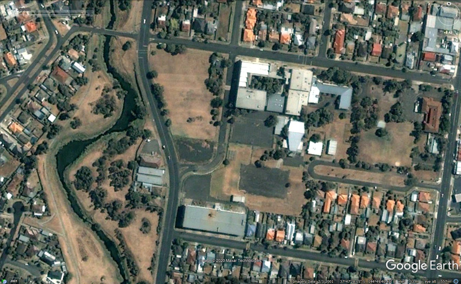
Google Earth, March 2001
In 1999 the Department of Education engaged Sinclair Knight Merz to complete a site contamination assessment, and the TAFE campus and remnant roadway was consolidated onto a single title.
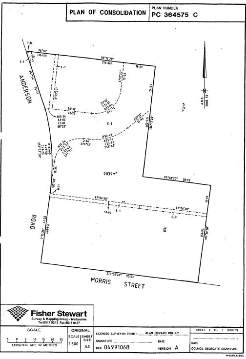
Plan of Consolidation, 40 Anderson Road
In April 2001 the land was sold for $1,673,000 to Blue Cross Community Care, who cleared the closed TAFE campus buildings.

Google Earth, April 2002
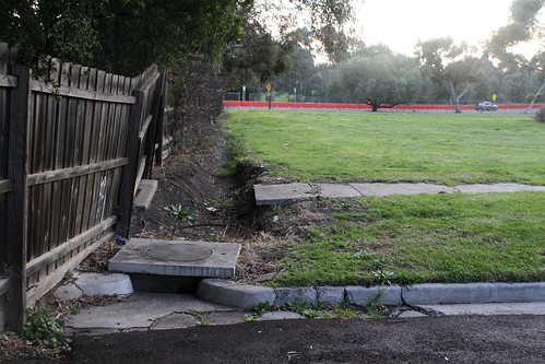
And built a nursing home on the site.

Google Earth, November 2003
Which occupies the site today.

And what about the ‘Graham Street South’ name?
Diving back into subdivision plans, I finally got a lead.

The list of modifications states that the street name was amended to Anderson Road in a Government Gazette.

Plan LP2694, list of modifications
Thankfully they are available online – Victorian Government Gazette G36 8 September 8 1994, page 2406
City of Sunshine
Change of Street NameNotice is hereby given that pursuant to section 206 and Clause S of Schedule 10 of the Local Government Act 1989, Council on 16 August 1994, resolved that Graham Street South, Sunshine, be renamed Anderson Road.
So it took 20 years after the Anderson Road realignment for the name to be changed, and 25 years on signs still bear the old name.
A loose end
What happened to the initial ‘Anderson Street’ name? Some digging around on Trove found the answer to that question, in the 4 August 1939 edition of the Sunshine Advocate.
Shire of Braybrook
Notice is hereby given that the Council of the Shire of Braybrook in pursuance of the powers conferred by the Local Government Act 1928 did at a meeting of the Council held the 24/7/1939 order that the street running north and south to Wright Street to Morris Street and connecting with Graham Street, known as Anderson Street, be renamed Graham Street South.
E. Hargraves
Shire Secretary
Quite the history of names – Anderson Street to Graham Street South, then back to Anderson Road.
Footnote: Flynn Place
For some reason Google Maps calls the stub of Graham Street South leading into the nursing home ‘Flynn Place’.
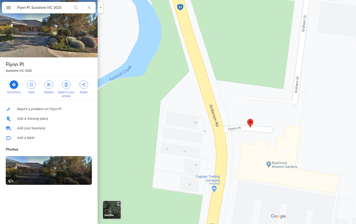
I can’t find any official reference to the name in the Land Victoria database, but Reverend John Flynn, founder of the Royal Flying Doctor Service, grew up in Sunshine – is this street a tribute to him, or just another mapping error?

Good sleuthing. Maybe Flynn Place is deliberate copyright map protection error.
Flynn Place could be a trap street, at least insofar as its name.
Flynn Place is included on OpenStreetMaps, and also on VicPlan. It is not listed in the Brimbank Register of Public Roads. So, it simply wouldn’t be a public road. Part of 40 Anderson Rd.
Similarly, Graham St is a public road only to the southern boundary of 135 Derby Road, despite the rest of it being shown on maps.
Land Victoria, which predated VicPlan, handled Flynn Place in a strange way – named, but no road reserve.
https://wongm.com/wp-content/uploads/2018/11/Land-Victoria-map-Graham-Street-South-Sunshine.jpg
Also interesting that the Brimbank Register of Public Roads includes an “Unnamed Lane North of Chapman St”, which is shown only as a highlight/outline on maps. The maps show another outline/highlight of a similar lane north of Benjamin St, but it doesn’t seem to be included on the Register of Public Roads.
Correction: the lane has a different Melway reference! 40H2 instead of 40G2.
The block bounded by Anderson Road and Wright Street has back lanes running behind the main streets, none of which are named. I believe a handful of them have been discontinued, the land sold the neighbouring owners.
[…] my adventure into the history of ‘Graham Street South’ in Sunshine, I ended up following another rabbit hole – the streets cut in half by the […]
[…] Graham Street South? Turns out the block bounded by Graham Street and Derby Road was once covered by houses, but a […]
[…] example I found was on Anderson Road in Sunshine, and offered travel times to Taylors […]