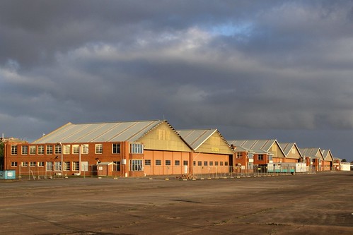
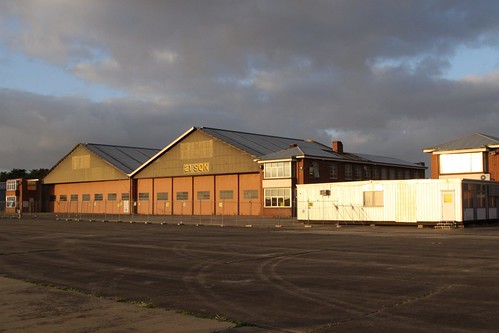
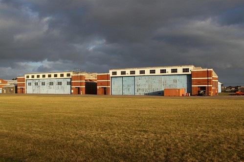
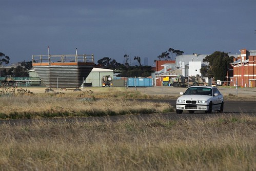
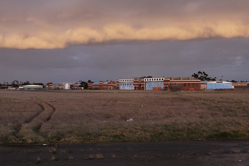
A few months ago I took a look at the control tower that once stood sentry over the former RAAF Williams airfield in the Melbourne suburb of Laverton – today I’m going for a drive down the runway to the heritage listed aircraft hangars.
The first aircraft hangars at Laverton were constructed in 1926-1928 for the No. 1 Aircraft Depot (No.1 AD) of the Royal Australian Air Force, with further expansion carried out when the No. 21 Squadron moved to the base in 1936. The depot went on to play an important part of supporting Australia’s involvement in World War II, with thousands of aircraft had been assembled and tested at Laverton, while many others had been repaired or modified following mechanical failure or damage sustained in battle.
After the war the airfield continued to be a testing ground for new aircraft, remaining in this role until Avalon Airport began to take over in the early 1960s. Flight operations officially ceased at Laverton in September 1996, with the last aircraft departing in February 1998: a de Havilland Vampire jet from the RAAF museum fleet. On closure RAAF Williams was divided into two: the eastern side remained a military base, while the empty airfield was sold to a private developer for housing.
As for the aircraft hangars, they were retained by the RAAF, and added to the Commonwealth Heritage List as a Listed Place in 2009. Two precincts are detailed on the listing, as seen on the map below.
The area enclosed in yellow is “Precinct 3 – Eastern Hangar Precinct” and consists of three pairs of aircraft hangars built in the 1930s, along with their associated workshops and offices.
Enclosed is red is “Precinct 6 – No 1 AD (West Workshops)”, which includes a large collection of buildings once used by the No.1 Aircraft Depot. Most noticeable in this block is a pair of large brick hangars, but three prefabricated metal hangars also occupy the precinct, along with a half-dozen brick warehouses and smaller office blocks.
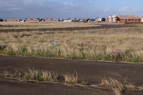
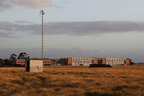
Once beyond the boundary fence of RAAF Williams, the remains of the airfield have been harder to find since work started on the new suburb of Williams Landing, which is taking over the site. Out in the middle of the airfield is this lonesome little radio mast…
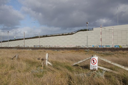
Down at the south end of the runway the approach lighting can still be seen, as can the special arrangements made to the overhead wires on the Werribee railway line just a short distance past the threshold. As well as being a lower than normal height to give extra clearance, the stanchions supporting the wires were painted in red and white strips for greater visibility.
The big concrete wall behind the railway was only built in the past few years, and forms part of the Palmers Road interchange on the Princes Freeway, with the road soon to be extended across the tracks into the new suburb.
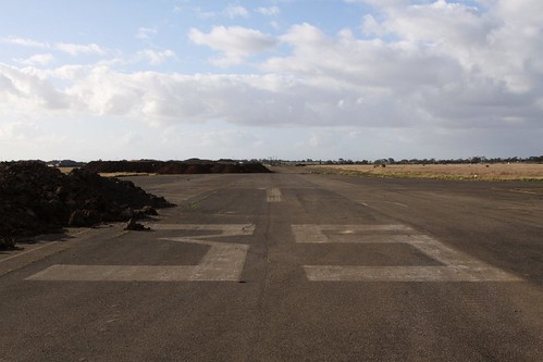
As for the runways themselves a little over half remains: the southern portion of runway 35, the eastern leg of runway 23, and the northern stub of runway 17. No long stretches of pavement remain – the runways having used a dumping grounds for spoil or dug up during the laying of pipes – so no testing your car on the 1/4 mile.
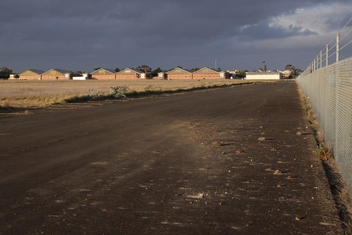
By comparison the taxiway towards the hangars is in better nick, and they look to be popular among local lads wanting to cut some off-street laps.
Work stared on the suburb of Williams Landing in early 2009, with the houses now covering around a sixth of the site. With the sun setting on the runways, it will only a be a few more years until the airfield is gone forever.
Further reading:
- Commonwealth Heritage List: place 106002: Statement of significance for RAAF Williams Laverton

Have you seen these lately ? They git heritage listed while redevelopment was being considered and they were going to demolish all if them, so the compromise in the end was to keep one, and deconstruct a second one and move it next to the retained one – dont know if that’s happened yet but probably……
I haven’t been past lately, so unfortunately no updates on that front. The hangars are all located on Commonwealth land, so the current round of property development won’t touch them – just surround them with tilt-slab concrete boxes.
Does anyone have WWII era pictures of this base….? Aerial photos will be best…..
And does anyone know what the length of the runway was during the second world war…..
I am trying to recreate these ARD’s for flight simulator X. This base will be the second in the series of bases I am recreating…..
14 ARD @ Gorrie was the first one….
Any help with this pictures would be greatly appreciated…..
Thank you.
Craig.
The Australian War Memorial has some photos in their collection – this one from 1955 shows a de Havilland Vampire outside the hangars:
http://secure.awm.gov.au/collection/127927/
The State Library of Victoria also has a few – this aerial photo is from 1938, and shows a much smaller runway than the post-war years:
http://handle.slv.vic.gov.au/10381/20318
In addition, in 1998 the Australian Defence Force Journal ran an article on the airfield – apparently a number of libraries hold a copy of it:
http://trove.nla.gov.au/version/52101567
I have enjoyed your series on RAAF Base Laverton where I serve during the 80’s
Look for ward to any follow up that you do. Check out the pics on my FB album, when 21 sqd was a working unit in our west hanger.
I was based at Laverton from 1969-1972-3 when I was posted to Williamtown.The pics of the hangers bought some memories back when I was there.I was in RPPU until the posting
[…] Landing station opened in April 2013, while the only sign of the former airfield is the heritage listed aircraft hangars next […]